Tuesday, August 21, 2007

Computer and phone advice

I mentioned in a previous blog how valuable my laptop computer was on my trip because I was able to use it to keep up with the weather, things to see, travel distances and routes, as well as getting my email and doing my banking while I was on my extended trip. One thing I discovered however was that as I traveled the computer would bounce around in my saddlebag and after a while I noticed an area on the monitor that was beginning to get worn. After noticing this, I began putting a cloth between the keyboard and the monitor to minimize this wear and tear, and it worked. I am glad that I noticed this early on in the trip. I also had to do the same thing with my cell phone which I kept in a case on my belt. The buttons on the keypad were causing marks on surface of the screen on the phone. I again put some pieces of paper towels over the surface of the keypad and this eliminated the problem.

The Beef Jerky Travel Diet

When I travel I usually do not like to stop for lunch and I very seldom go out for dinner either. This is a good thing because it saves me money and it reduces my calorie intake, which is something I need to do desperately. As I travel, I usually eat about 2 ounces of beef jerky and one crunchy granola bar for lunch. Breakfast is usually whatever is free at motel which usually consists of a bowl of cereal, an English muffin, and a piece of fruit. For dinner I would stop at a local grocery store and pick up a quarter pound of sliced ham, two pieces of fruit, and some carrots or other suitable vegetable to munch on. I did go out to eat several times when I was at one of my relatives homes, but even then I would try to eat lighter portions. The result is, after 5 weeks, that I lost about 10 pounds. Now I just have to try to keep that up now that I am home.

Some of my friends suggested that I should write a book about my "Beef Jerky Travel Diet" to compete with books like the South Beach Diet or the Atkins Diet. I really don't think I have a have enough material to make this into a book however. I suppose I could write a book about the different jerkies I have eaten along the way. One of my favorites was the Gary West Jerky that I picked up in Jacksonville, OR.

After thoughts and upcoming videos

For those of you that have been following my blog I want to thank you for your interest in my journey. It was encouraging to me to have so many people show an interest in what I was doing for myself. Now that I am home, I will be working on editing the videos that I took on my trip. If you are interested is seeing them I will be posting them on YouTube and I will put a link to the YouTube site on my blog. Since I am not sure when I will have the editing done, if you want to send me your email address, I can send you an email to let you know when I have posted something new. If interested, please respond by sending me your email address to:
gesvendor@westshore.edu

You will need to send it directly to my email because I cannot respond directly to if you you contact me through this blog site.

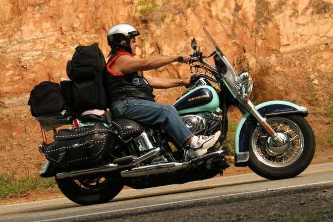
Day 34 - My last day on the road


Picture 1 - A flower garden in the Open Space in Traverse on the West Bay. Picture 2 and 3 - The state park beach on the East Bay in Traverse City. Picture 4 and 5 - The Boardman River behind the stores on Front Street in Traverse City.

Today was the last leg of my trip but it certainly did not lack in regard to beautiful scenery. Michigan is a very beautiful state and has some of the best lakes and shoreline when compared to others I have seen around the country. On my way home today I decided not to take I-75 but instead to use US-31. I have not traveled this way in many years but after witnessing the beauty of this route, it may again become the route of choice when I travel north to the Mackinaw Bridge from now on. As I traveled through towns like Petoskey, Charlevoix, Conway, Elk Rapids, and Traverse City, I was struck by the beauty of the lakes, woods, and shoreline that help to make Michigan one of the most beautiful places I have seen on my trip. I have seen the beaches of California, Oregon, and Washington and they do not compare to the beaches here in Michigan. Oregon was the closest, but the constant cold breezes that come in off the ocean in every one of these states, makes them virtually useless for what most people go to the beach for; i.e., swimming and sunbathing.

The weather was cool today, but as I left Petoskey it was at least partly cloudy so the traveling was delightful. It wasn’t until I passed Bear Lake that I knew that I was going to need my rain suit to complete the trip home. I no sooner got it on and the rain started to come pretty steady for the last 40 miles of the trip. So the journey ended as it began; with cool weather and rain. But I must admit this did not dampen the enjoyment of what I have experienced on this 8,100 mile ride.

Speaking of all the miles, when I was talking to a guy at the motel last night about my trip, I mentioned that I had ridden 8,000 in five weeks and he said, “Wow, you must have a leather ass by now.” I guess I probably do with all the miles I put in the saddle, but I have to admit, that the seat on my Heritage Softail Classic was quite comfortable the entire trip.

I have included some pictures above from the Traverse City area. Traverse City holds a special place in my heart as one of the best vacation spots in the world because it is where my parents and other relatives used to go to vacation when I was a kid back in the 40s and 50s. I was always fascinated by the Boardman River in Traverse City and the way it meandered through the downtown area right behind the stores that lined Front Street. As I rode out of Traverse City down Front Street and onto North Long Lake Road toward Long Lake where we spent many a summer, I was reminded of those wonderful years when we would go fishing on some of the smaller lakes in the area. As I passed by them I could still remember some of the fish I caught on lakes like South Twin, Coffield’s, Obrien’s, and Lions. The memories washed over me like a flood as I passed along side these lakes and especially Long Lake with its beautiful islands and sandy shores. It was a great way to end a great trip; i.e., remembering the best vacations of a lifetime some 50 and 60 years ago and reflecting on the journey of a lifetime that I have dreamed about doing for many many years.


Saturday, August 18, 2007

Day 33


All of the pictures are from Palms Book Spring State Park in the Upper Peninsula near Manistique. This is Big Spring or "Kitch-iti-kipi."
Today was my second day in the UP of Michigan near Houghton. The temperature this morning dropped to 32 degrees F and there was frost on the ground. Joyce, Juhanni, and I went to house Chris and Maryann’s house for breakfast this morning. Chris is Joyce’s son and Joyce is my mother-in-law. Juhanni is Chris’ son who has been staying in the big house at the Bohjanen farm where Joyce lives. Maryann, my sister-in-law, made a traditional Finnish breakfast delicacy called Pannukakku. It is mostly egg and milk and is baked in an oven like a soufflĂ©. We ate it with a strawberry topping and it was delicious. When I left Houghton, the sun was shining but it was still cool. After riding for about and hour the sky got overcast and I got pretty cold so I stopped to put on more clothes. After putting on a second long sleeved shirt, and my chaps, I headed back out on the road. With the thin layer of high clouds and a lower level of stratus clouds, the temperature never got above about 65 all day, so the extra clothing was a big help, but I never did get fully warmed up. The towns clicked off as the miles flew by. Towns like Baraga, L’Anse, Ishpeming, Negaunee, and Marquette.

At Marquette I turned south on MI-41 to head down to US-2 at Rapid River. I decided to take this route because it will take me past Palms Book Spring State Park just west of Manistique. This is where you can find one of the Upper Peninsula's major attractions, Kitch-iti-kipi or "The Big Spring." Kitch-iti-kipi is two hundred feet across and forty feet deep. The spring spews out over 10,000 gallons a minute from many fissures in the underlying limestone. The flow continues throughout the year at a constant 45 degree temperature so the spring never freezes and can be enjoyed any season of the year. On the spring is a barge that is guided by a cable stretched across the spring. The center of the barge is open so you can easily see the bottom of the spring in the crystal clear water. Swimming beneath the barge are numerous trout that have been planted there from nearby fish hatcheries. I have posted several pictures from Kitch-iti-kipi including one looking through the bottom of the barge showing some of the trout and the boiling sand at the bottom of the spring. I have been here once before about 20 years ago but the visit today was just as delightful. The spring is truly awesome.

After leaving the spring, I headed toward St. Ignace with the intent of finding a motel there to stay the night. I had forgotten that today was Saturday during the height of the tourist season and every motel that I checked with was full, so I decided to cross the bridge and try my luck there. Most of the motels south of the bridge were full too, so I continued south on US-31. I finally found a motel in Petoskey so this is where I am for the night. I might have just ridden all the way home tonight but I found out that it had been raining in Ludington all day and I was already cold. I didn’t relish the thought of being wet and cold.

Today, the odometer rolled over the 30,000 mile mark since I bought the bike in 2002. On this trip, which has lasted one day short of five weeks, I will surpass the 8,000 mile mark which will occur tomorrow before I arrive at home. Home is approximately 160 miles away if I don’t take any detours.

Day 32


This next part actually happened yesterday, but I was so long winded on what I wrote in yesterday’s blog that I decided to split up some of the information. As I rode on from Duluth, I entered Superior, Wisconsin where I stopped at Barkley Island. There is a rubber sided ship on display in the harbor there which was rather unique with its rounded sides. You can see it in the picture above. Northern Wisconsin was exactly like Northern Minnesota and Northern Michigan; very wooded with lots of lakes, rivers, swamps, and hills. I eventually made my way into Michigan and headed toward Silver City near the Porcupine Mountains Wilderness State Park. I had always wanted to see the Lake of the Clouds which is located there so I took a 9 mile detour to the west of Silver City and a short walk up the hill to see it. The lake was quite beautiful and I was glad I took the time to ride up there. I have a couple of pictures of the lake posted above.

Today, Friday, it was quite cool but sunny. It was also extremely windy so I decided not to go for any extended rides on the motorcycle to see any of the sites around the Keweenaw Peninsula. I did take a few pictures of the Bohjanen homestead which I have stitched together as one and included it above.

Friday, August 17, 2007

Day 31


Today I left Grand Rapids, MN and headed toward Duluth, MN and eventually to Joyce Bohjanen’s home in Oskar, MI just north of Houghton, MI in the UP. Joyce is my mother-in-law and has a beautiful 40 acre homestead way out in the north woods. All the way through Minnesota, Wisconsin, and Upper Michigan I was struck by the beauty and similarity of these three states. With their abundant forests and the beautiful lakes I felt like I was really home again. It felt good to be back in familiar territory. What a wonderful change over the prairies in North Dakota and eastern Montana.

On my way down US-2 toward Duluth I was on the lookout for a large steam locomotive that a friend of mine wanted me to take a picture of. He is a truck driver that made a lot of runs through Duluth and was always captivated by the size of this locomotive. He was never able to get a picture of it because there was no place for him to stop with his 18 wheeler. Before heading out toward Duluth I did some research on the computer to see if I could locate where it was. I was not able to find it online but I did find a Railroad Museum in Duluth so I programmed that into my GPS. I figured if nothing else, I could go there and someone would know were it was. I recall as I rode through town of Proctor, just outside of Duluth, my attention was drawn to an Air Force Jet that was poised on a pedestal on the side of the highway. I thought about stopping there to get a picture of it because it was quite neat, but I was going just a little too fast to stop so I just kept heading toward the museum. Shortly after that I saw a turnout for a rest area and tourist information site which I also thought about stopping at but I decided against it at the last minute. After rounding a curve and cresting a hill, I got my first view of Duluth and the harbor on Lake Superior. It was absolutely gorgeous. At that point it was too late to stop to get a picture but I decided that after visiting the museum I would probably go back to that information rest area because it was on an even higher hill overlooking the city and would allow me to get some good pictures.

Upon arriving at the Museum I parked my bike on the street and took both cameras with me to try to get some pictures in the museum. The building that housed the museums (there were actually four museums in this building) was a beautiful old train station. From the road outside I took my 35 mm camera out to take a picture of the building. I noticed that I did not have my memory card in it because I left it in the computer. I thought for a moment that it would be okay because I still had my camcorder with me and it takes pretty good still pictures along with videos; but since I was only a half a block away from my bike I decided to go back and get the memory card. I was so glad I did because when I finally got in the place and tried to take some video I discovered that the battery was dead on the camcorder.

Upon entering the museum, I asked the person at the ticket counter if he knew of a train located along US-2 somewhere. He told me it was right along side the highway in the town of Proctor and you can’t miss it as you drive through. Well Proctor is the town I had just come through and I did miss it. I guess eyesight is the first thing to go when you get old; or is it the second? He told me that if I head back to Proctor, just after passing the first red light, I will crest a hill and the train will be on my left. I thanked him and went about the business of visiting the Railroad Museum. I was impressed by the number of restored old trains that they had on display inside the building. I took a lot of pictures, some of which you can see above. While I was there I also got a short ride on and old restored electric trolley. This trolley was actually built in South America and was used in Duluth for many years. There is a sister trolley that is still in use in Alaska but it has been converted to diesel.

After leaving the museum, I headed back to Proctor to find the locomotive that I somehow missed on my first pass through. As I came to the first red light, I could not see it yet but as I crested the hill I discovered why I did not see it the first time. It was right next to the Air Force Jet that is also on display next to the highway. Anyway, I stopped and got some pictures of the jet and the train and headed into Proctor to get some lunch. At the restaurant I found out that the engine and tender car for this locomotive was 127 feet long and the engine was the most powerful engine in the world at the time.
After eating I then head back onto US-2 to make a stop at the tourist information center to get some pictures of Duluth and the harbor. The view from that hill was breathtaking and I was extremely glad that I came back that way to see it and get some pictures. While I was there I met a nice couple from Boston who had been vacationing in Minnesota and were driving back through Upper Michigan, then Canada, and back to the US in the Thousand Island area on the St. Lawrence Seaway. In our discussion I discovered that he had actually been born in Ann Arbor, MI. They asked for my recommendation on what to see as they passed through the UP. I recommended Pictured Rocks and Tahquamenon Falls. They wrote both things down and said they would definitely stop at each.

Wednesday, August 15, 2007

Day 30


Picture 1 - Sunflowers growing in a field. Picture 2 - Paul Bunyan and Babe the Blue Ox in Bemidji, MN. Picture 3 - Paul and Babe but this time in Oregon taken several days ago. Picture 4 - Large Muskie outside of a bar in Minisota.
This morning I started in Minot, ND and rode to Grand Rapids, MN; a total of 325 miles altogether. The riding was easy and fast. With the speed limit at 70 in North Dakota I was usually running at 75 mph most of the day with spurts up to 80 from time to time. The terrain started out much like yesterday, mostly flat farm land or grazing land. The farther east I went, however, the more I began to see some ponds in the fields, then bigger ponds, and then lakes and bigger lakes. It was nice to see some lakes along the way, but the lake were pretty much wide open. That is, there were no trees around most of them. They were just lakes in a field. Once I crossed over into Minnesota, that is when the landscape really changed. Northern Minnesota looks a lot like the Upper Peninsula of Michigan. Covered with trees and the lakes are surrounded by trees. I felt like I was home again; and it felt good.

Let me say something about highway US-2. Before I started my trip a number of people warned me that US-2 might not be in that good a shape because it is not the primary rode for cross country travel like it used to be. I was, in fact, a little apprehensive about taking that route at first, but now that I have been on it from Seattle, WA to Grand Rapids, MN I can tell you that there is nothing wrong with this road. Ever since Montana, the speed limit on the road has been 70 mph (except for in the towns) and 70 is a comfortable speed for the condition of the road; which is good. What I like most about it is that you can travel just as fast as on the interstate, but with much, much less traffic and very few trucks; and you get to see all the little towns along the way. In Montana, US-2 was a two-lane road for the entire state. But with so little traffic, it presented no problem because there was hardly ever anyone to pass along the way. In North Dakota US-2 becomes a four-lane divided highway, but it is not limited access. The four lanes obviously makes passing easier, but still there were very few people on the road to pass anyway. There are only about 30 miles that are not four-lane but they are currently working on that section and it will probably be done this year. Once I got to Minnesota the speed limit dropped to 65 and in Bemidji, MN the road again turned into a two-lane road. In Minnesota the towns are a little closer together than in the other states.

As I rode today, and also a few times yesterday, I came across several huge areas of sun flowers growing in fields. It was quite nice to see some color other than the tannish brown wheat fields that I have see ever since Washington State. I stopped to take a picture of one of the fields, which you can see above. In Bemidji, MN I had to stop to take a picture of Paul Bunyan and Babe the Blue Ox. This is not the first time I have seen these characters. There was a statue of them in Oregon as well; right near the California border and the redwood forests. I have included both pictures above. Halfway between Bemidji and Grand Rapids, I came across a bar that had a huge muskie outside of it. The muskie was actually a building. The doorway was in the mouth and you can see windows on the side as well as a small chimney coming out the back near the fish’s dorsal fin.

Tuesday, August 14, 2007

Day 29


Today I took only one picture so I decided to include three pictures from two days ago. Picture 1 – Bridge over Lake Koocanusa about 30 miles north of the Libby Dam. Picture 2 – The gorge and river in Glacier Park where kids were jumping into the river. Picture 3 – A close up of the pool they jumped into. Picture 4 – An old steamboat that was used on the Missouri River near Wolf Point, MT.

Last night I stayed in Glasgow, MT and I rode to Minot, ND to end my day; a distance of about 280 miles. Rain threatened all day but I never got any rain until I secured my motel room in Minot. Then we had about 5 minutes of drizzle. In Williston, ND, which was about half way on today’s ride, I stopped for lunch and checked out the weather channel weather map on my computer. There was a huge band of thunder storms about 60 miles south of my position that stretched almost the entire width of the state. This would have put it smack dab on top of I-94 which made me glad that I was riding US-2 rather than the interstate.

Having left Montana, let me summarize my thoughts about this state. First of all, Montana is one wide state. Riding on US-2 from the Idaho border to the North Dakota border is about 680 miles. That is the equivalent of the distance between Lansing, MI and New York, NY. On the western end of Montana the terrain in mountainous and heavily forested and I might add; it is quite beautiful. Riding through Glacier National Park was some of the best scenery that I have seen anywhere. Once I left Glacier Park, I entered the town of Browning which was probably one of the dumpiest towns I have come across on my trip. Later I found out that it is a town on an Indian Reservation that has an extremely high crime rate and murder rate. Four people had been murdered there in just the last two months with the most recent being just one day before I passed through the town.

From Browning all the way to North Dakota, the terrain changed from mountains to flat dry farm and grazing land. The roads changed from twisty to fast and straight. Riding on US-2 was nice for a change but the scenery got to be a little boring. All along US-2 there were little towns dotting the way about every 20 miles or so, with absolutely nothing in between. The towns were obviously populated by Native Americans because I have never seen so many casinos in my life. Every town had at least one casino and in some towns there were dozens. There were casinos everywhere. They were in gas stations, liquor stores, restaurants, and casinos all by themselves. In my mind, I imagined that Montana to be all mountains and lakes. Boy was I wrong. It is like that only on the western third of the state. Otherwise, it was flat prairie land.

On today’s ride I stopped at three historic sites. The first told about how, in 1837, the Little Girl Band of Assiniboine Indians were exposed to smallpox by the European trappers. The exposure wiped out 94% of the entire tribe. Numerous other tribes were exposed to the disease as well with almost as devastating results as the Assiniboines had. The second was at Wolf Point, MT which told about the Lewis and Clark Expedition which passed through that area in 1805. I might add that I have crossed over the Lewis and Clark trail several times in the last few days. Wolf Point got its name because in 1879 trappers killed several hundred wolves and piled them up along the Missouri River for the steamboats to see as they passed by. The final site was tribute to the steamboats that used to run up and down the Missouri River bringing supplies to the settlers and forts that were populating the area. I have included a picture of one of the steamboats above.

Monday, August 13, 2007

Day 28


Picture 1 is the picture of the dinosaur at the Philip County Museum in Malta, MT. The picture was actually 4 separate pictures that I took and then stitched together using the panorama feature of my Olympus Master editing software. Picture 2 are some antique clothes from the museum.
Today there isn’t too much to report today. Before leaving I noticed that my cycle cover had some white stuff on it when I went to take it off. At first I didn’t know what it was but then I figured out that it was ash from the distant forest fires that are raging in Idaho and Montana. I left Cut Bank, MT this morning heading east on US-2. For the most part US-2 is as straight as an arrow and has a speed limit of 70 mph. The riding was easy, but the scenery left a little to be desired. Ever since I left Glacier National Park, the land flattened out and became wheat growing or cattle grazing farmland that stretches as far as the eye can see. It has been that way for well over 300 miles. Except for the river valleys, there are almost no trees anywhere. Actually the straighter road riding is kind of a relief from all the twists and turns that I experienced all along the coast and through the mountains that have dominated my riding for the last two weeks or more. Riding US-2 is also a whole lot better than riding the interstate highways. There is definitely a lot less traffic.

Because of the lack of scenery I started to stop at most of the historical markers that were along US-2 near each of the towns that I rode through. I found out about people like: Chief Joseph, Chief of the Nez Perce Indian tribe; Flat Nose Curry, Butch Cassidy, and the Sundance Kid; the slaughtering of the free range buffalo in the 1880s; and things like the various kinds of cattle brands. In the town of Malta, MT I stopped at a museum. The key item at the museum was a complete skeleton of a brachylophosaurus dinosaur that was found near there. This dinosaur is an early cousin of the T-Rex. It measured 28 feet long. The museum nicknamed the dinosaur “Elvis the Pelvis.” I included a picture of Elvis above.

Day 27


Picture 1 – Mountains in Glacier Park . Picture 2 – Entrance to Glacier Park. Picture 3 – Upper Libby Dam and Koocanusa Lake. Picture 4 – Libby Dam

Today was a really great day. It started out with a ride up to the Libby Dam on the Kootenai River which creates the 90 mile long Koocanusa Lake. Forty-two of the lake miles are in Canada, the rest are in the USA. Although the dam does generate electricity, its primary purpose is to control flooding in the area by storing up the spring run off and releasing it over the summer and fall. As I rode along the lake I stopped to watch some people that were rock climbing. There were actually several groups of people.

Glacier National Park was simply fantastic. People told me that it was beautiful, but until you actually see it for yourself it is hard to imagine what it looks like. When you first enter there is a large lake on your left which is really beautiful. Then you begin to rise in altitude and the lake changes to a river and the mountain tops start to come into view. As you rise up further the mountains become more visible and more majestic. They are breathtaking. Part way up, I stop by a waterfall in the river to take some pictures. Just above the falls area is a neat canyon where the river forms a deep pool that swimmers were jumping 15 feet off the canyon walls into.

As you ascend further the mountain become even more rugged than before. During the first part of the ascent, I was on the inside lane, but after negotiating a very sharp switchback I was then in the outside lane for the rest of the ride on the Road to the Sun. About 5 or 10 miles before the end of the Sun Road as I approached the town of St. Mary, another lake appeared but this time on my right. When the lake ended the St. Mary River started.

Once I was out of the park I got on MT89 and headed south. This road took me through an area that was recently burned out by a forest fire. In a few more miles the mountains turned into rolling foot hills with horses and cattle roaming on a free range. Some of the horses were even on the roadway. The farther east I rode the flatter the terrain got and the drier it got. Then the wind started to pick up. It must have been gusting up to 50 miles per hour. I was glad when I turned east so that the wind was at my back. I was traveling on US 2 at about 75 MPH but it didn’t seem that fast because I didn’t feel the wind as much.

Sunday, August 12, 2007

Day 26


Picture 1 - A neat restored schoolhouse near Reardan, WA. Picture 2 - Kootenai River in Idaho. Picture 3 & 4 - Kootenai Falls in Montana. Picture 5 - Me standing in front of Kootenai Falls.
This morning I left Davenport heading for Shumate Harley Davidson in Spokane, WA. I just turned over 6,000 miles and needed my second oil change of the trip. My first oil change was at Santa Barbara H-D in Carpenteria, CA, just a couple of weeks ago. Although I am not in the business of writing about dealers on my trip, I think a comparison of the two might be in order. I called ahead at both dealers to see if I could get an oil change and both could accommodate. Both were very friendly and both had me in and out within an hour. Now let’s talk about the differences. In California they tried to add on all kinds of extras which would have cost me $341. After I objected and said all I wanted was and oil change, he backed out some of the items. When it was done I ended up with a bill for $145 for an oil change. This was the first time I ever had my oil changed at a dealer before so I did not have anything to compare it to. Today I was surprised to find out that my cost for the oil change in Spokane, WA was $66 and they even checked over the bike to make sure everything was still in place and nothing had come loose. I realize this is a small sample from which to base an opinion, but when an oil change costs more than twice as much, at one dealer over another dealer, I am forced to state my opinion. First I want to express my thanks to Shumate H-D in Spokane for doing a great job at a reasonable price. My recommendation to anyone planning on making a long trip on a Harley; don’t get your oil changed in the Los Angeles area and especially not at Santa Barbara H-D in Carpenteria, CA. I am not sure that the price was high just because it was near LA, but I would not want to test the theory if I were in the LA area again.

While I was at the dealership in Spokane, a delightful 68 year old gentleman overheard that I had ridden Route 66 and he couldn’t stop asking questions about my experience. I filled him in on some of the generalities of the trip and advised him to check out my blog if he wanted more detail about my experience. He told me that he would definitely do that because he wanted to ride it next year.

After leaving the dealership I programmed my GPS to take me to Glacier National Park. Because I was already east of US-2 the GPS pointed me to Idaho 95 which would head north and eventually connect with US-2. This seemed reasonable to me so I followed the GPS, but did that ever turn out to be a mistake. The problem was not with the road or the route, it was the fact that this route took me past a large amusement park in Sandpoint, ID. This being a weekend, the traffic was especially heavy on this road and to make matters worse, there was a major accident just north of the park which completely closed down the road. This created a major traffic jam that took me about an hour to get through, and when I finally thought I was through it, I found out that I then had to take a detour around the accident that was ahead.

After getting through the traffic problems I eventually linked up with US-2 and the ride again became delightful as usual. It wasn’t long before I was riding in the Idaho mountains next to the majestic Kootenai River. The longer I road along the river the nicer it got. I eventually came across a turnout that boasted a view of Kootenai Falls. I almost passed it up, but decided to make the stop; and am I glad I did. This river was one of the most powerful rivers I have seen on my trip. The falls are not large in terms of height, but the rush of water through this gorge and around the rocky islands was overwhelming. I was totally blown away. I took some really good video of the falls and some pictures as well. The pictures are good but they do not give the total impression that you get from the videos. Even the videos don’t capture it all, however. One aspect not captured on the videos is the thunderous sound that engulfed you as you stood near the river. The videos could pick up the sound of rushing water which by itself was impressive, but what it didn’t pick up was a thunderous din which emanated from the falls and reverberated from the surrounding mountains and canyon walls. At first I wasn’t sure it was there, but the longed I stayed there, the more I was aware of its presence.

You may recall that I had previously talked about the Meryl Streep movie, “The River Wild,” which was partly filmed at the Hellsgate, Canyon on the Rogue River in Oregon. I have now discovered that the movie scenes involving the major rapids were filmed at this site on the Kootenai River. I can easily see why they chose this spot.

Currently I am at Libby, Montana which is about 100 miles west of Glacier National Park which I intend to visit tomorrow. I have passed the 6,000 mile mark on my odometer and I have now been it 15 different states on my trip. When I started this journey, I had a vision of what I expected to experience. Although some of what I envisioned has been correct, the extent of what I have really experienced has far exceeded the vision. This is probably not unusual because how can you know what is there until you actually get out and see it for yourself. If you aren’t able read into the meaning of that statement, let me spell it out for you. Get out and discover America. You will never regret it. This is one great country.

Saturday, August 11, 2007

Day 25


Picture 1 - Grant and me heading to Davenport. Picture 2 - Chris, Zach, and me going for a ride. Picture 3 - Leena and Donny's front yard. Picture 4 - Front of their house.
I stayed at Leena’s house today and did not travel so there is not too much to report today. This morning I took Grant with me into Davenport to go to the post office to mail
Heather’s car keys back to her that I had in my pocket when I left. I also mailed out another package as well. While I was in town, I parked outside of Donny’s office to connect to the wireless internet so I could post my blog and to check my email. After that we headed back home and I gave the other two kids a short ride on the motorcycle because they have been bugging me for a ride ever since I arrived yesterday. While I was in town, I also called the Harley dealer in Spokane to see if they would be able to change my oil on Saturday morning. They indicated it would not be a problems so I will stop there on my way out tomorrow.

Once I leave Spokane, I will be getting back on US-2 to head toward Glacier National Park in Montana which is 330 miles from here and probably about 275 miles from Spokane.
Last night we all went out to dinner at Milford’s Seafood in Spokane, WA. Following dinner we dropped Donny and Grant off at the railroad station so they could take a train to Montana to pick up Donny’s truck.

Friday, August 10, 2007

Day 24


Picture 1 – Pike Place Fish Market. Picture 2 – Bear and Yokoyama at Fish Market. Picture 3 – Wenatchee River along US-2 in the Cascade Mountains. Picture 4 – Leavenworth a Bavarian Village in the Cascade Mountains. Picture 5 – Svea, Zach, and Grant.

Today I left Heather’s house in Yelm, WA heading toward Seattle. My first stop for the day was going to be the world famous, Pike Place Fish Market. The fish market was one place that I could not pass up. Many of you are familiar with the Fish Philosophy training that I did at West Shore Community College. This training was based on the Pike Place Fish Market in Seattle, so I had to stop. In the training I dress up like Bear, one of the prominent characters in both the Fish book and Fish video. As it turns out Bear still works there and I was able to get a couple of pictures of him at the market today. Many of the employees are new since the Fish video was published, but there were two of the old guard that were still there and working today: Bear and the brother of Johnny Yokoyama. Johnny is the owner of Pike Place Fish and the person that helped to make it world famous.

One thing that surprised me about Seattle was how steep the streets are that lead to Pike Place. It reminded me of San Francisco. I felt a little uneasy riding down them and then back up as I was leaving. I think going up was worse because I hit every red light and had to keep the brake on to keep from rolling backwards while trying to feather the clutch and give it gas to get going all at the same time. I didn’t stay at the market long because parking was $5 for half an hour. Pike Place Market is actually a whole bunch of shops connected together. It was really crowded and difficult to move around. The best activity was around the Pike Place Fish market which is where I spent most of my time.

After leaving Seattle, I headed a little north to get on US-2 which would take me to Davenport, WA where my niece Leena lives with her husband Donny and their four kids: Grant, Svea, Zach, Maija. The trip there from Seattle was about 280 miles, but I had already ridden 60+ miles from Yelm to Seattle. What struck me most about the ride today were the changes in terrain and climate. For about the last two weeks, I have been riding along the coast and have always been west of the Cascade Mountains. Along the coast it has been extremely cold with temperatures mostly in the 60s for highs and the lows have been in the 50’s with a time or two in the 40s. As I headed up the Cascade Mountains I was struck by their beauty. Much like the Olympic Mountains, they looked a lot like the Swiss Alps. In Seattle I was pretty close to sea level. At the highest point in the Cascades, I was at just over 4,000 feet, but the surrounding mountains were much higher than that. The temperature was cool at that elevation but it began to warm up as I descended down the other side. For a long time US-2 followed the Wenatchee River which was a beautiful blue\green when it wasn’t boiling over in the rocky areas. US-2 was extremely beautiful through this section. With the mountains rising up on both sides of the road and the river running along my right side, it was all I could do to keep my eyes on the road as I traveled along. On the eastern side of the Cascades was the town of Leavenworth. This was a delightful little town that was patterned after a Bavarian town nestled in the Alps. It looked a lot like Frankenmuth, MI except that it was surrounded by mountains. Shortly after leaving Leavenworth, the terrain and climate made an abrupt change. The lush green mountains gave way to brown un-vegetated hills that looked more like the desert southwest than the northwest. The temperature jumped significantly as well. After passing over the Columbia River the elevation began to climb again as I rode up the desert-like mountains. What really surprised me was when I got to the top of the mountain (about 2,800 feet above sea level). There the land opened up into a vast area of wheat farms as far as the eye could see in every direction. The road at this point became straight as an arrow. The only curves in the road were the up and down undulations as the road contoured itself to the rolling terrain of the farmland. This lasted for pretty much the rest of my trip today which was at least 100 miles. I don’t think I have ever seen this much wheat farming in my life.
In Davenport, where my niece lives I discovered that her house was actually 16 miles north of Davenport and US-2. As I headed north I was again seeing nothing but wheat farms in every direction. It was only in the last few miles when I turned onto Porcupine Bay road that the scenery changed to pine covered mountains that were just beautiful. When my GPS took me on the last turn on the last road to Leena’s house, it wasn’t quite sure where her house was, so it took me past her house down a gravel road and left me in the middle of no where; and I me no where. Luckily they heard me go by and sent their son Grant out on his dirt bike to retrieve me and get me back to their place. I was relieved to see Grant coming because, as I said, we were in the boonies and I discovered I had no cell phone service

Thursday, August 9, 2007

Day 23


Picture 1 - Entering the Quinault Rain Forest in Olympic National Park. Picture 2 and 3 - Moss covered trees on the Maple Glade Trail. Picture 4 - An area with some huge cedar trees. Picture 5 - A huge log on the beach in the Olympic National Park.
Today I headed back to the Olympic National Park but this time to the southwest side and the Quinault Rain Forest. The ride there was on the cool side as usual but the sun peaked out every once in a while. I arrived at the rain forest just before noon and headed right for the ranger station to check out one of the trails through the forest. It only took a few steps into the forest to make me feel that I was in a different world. This place was just amazing. The trees were huge and in many cases completely moss covered. The forest floor was completely green with ferns, moss, and many other types of plants. Being in the rain forest was like stepping back into prehistoric times. I was expecting to see dinosaurs at any minute. There was a creek running the forest in one area and it was absolutely beautiful. The undergrowth in the forest came right up to the banks of the creek and into it as well. Everything was so lush that not even the water would keep the plants from growing. The creek ran into a pond that was just completely engulfed with plant life. It was really beautiful. The water in the creek was absolutely clear. Probably because there were so many plants to filter it. There are two rain forest areas in Olympic Park, but I only visited one of them. I would suggest that if you are ever in this area, put this on your must see list.

After seeing the rain forest I head northwest on US101 toward the coast and the beach areas of the Olympic National Park. Although the highway is right on the coast for several miles, you cannot see the ocean from the highway because there is a small hill full of trees between the ocean and the road. Being short on time I only rode as far as Beach 3. Each of these beaches had only a small parking area by the road and path that led down to the beach. Not seeing much of the ocean, I decided to turn around and go back to South Beach because it had a camping area and you could drive down to the beach area. I was not impressed by the camping area. It was nothing more than a long gravel parking lot with campers parked all along its perimeter. From the parking lot the land dropped off down to the beach. I wasn’t really impressed by the beach itself but what did impress me were the huge driftwood logs that had washed up on the beach. They were massive. You can see one in picture 5 above.

Tomorrow I will be heading up to Seattle and then out on US2 in the general direction of home, but first I will be stopping at my niece Leena’s house in Davenport, WA.

Wednesday, August 8, 2007

Day 22


Picture 1 is Heather on Mount Rainier. Picture 2 is a dammed up lake on the way to Mount Rainier. Picture 3 and 4 are Narada Falls which are at the 3500 foot level on Mount Rainier.
I know you have all been waiting for the one big event or the one big story that becomes the defining moment in my trip. All biker trips have to have at least one. This is the event that separates the men from the boys; the Harley dudes from the other bikers. Well, I think I have it for you today. If you haven't read the other blogs, that's ok; BUT DON'T MISS THIS ONE.

So far on my trip I have been staying in motels or on several occasions I have been lucky enough to stay with relatives. I want to thank Lisa in San Bernardino CA, Betty in Medford OR, David in Dundee OR, and now Heather in Yelm WA where I am currently staying. The time I have spent with each of them has been wonderful and I appreciate, very much, the hospitality they have shown me. In addition, staying with them has saved me hundreds of dollars in motel cost that I didn’t have to shell out. Today, however, I think I paid the ultimate price for staying with relatives, especially ones that have little kids. This morning Heather needed to take Aiden to his swimming lesson so I volunteered to baby sit for Keilani (4) and Hailey (7 months). When Heather left, Haley was napping but woke up just as she was leaving. Heather had given me instructions on how to warm up her formula and where the diapers were in case I needed them. Haley was just fine playing for a while but then she started to fuss and Keilani said she was probably hungry; so I warmed up the formula and Haley started to eat. I decided that I better burp her so I walked over to get a dish towel to put over my shoulder. As I grabbed the dish towel and put it over my shoulder, I discover some yellow stuff on Hailey’s arm and my hands. Upon further investigation, I could see poop coming out the back of her diaper. It was all over my arm, shirt, and the baby’s clothes. What a mess! Every time I tried to lay her down to get something to clean her up with she would scream, so I would pick her up again. I laid down a dish towel on the counter but then I couldn’t get to the water so I move everything closer to the sink. Every time I would try to take her shirt off she would scream, but eventually I got it off. Then the pants; after trying to unbutton or unsnap them for about 2 minutes I realized that the button was just for decoration, so I pulled the pants down and off. It was at this point that I saw the extent of the mess. It had squeezed out of her diaper and was all over her back and legs. Using wet paper towel, I finally wiped off most of the exposed poop. It was time to dig into the main event. After untaping the diaper I pulled it away. I could see I still had a lot more work to do. With Hailey fussing all the while, I eventually got the entire mess cleaned up from her body. Now my next dilemma; I could not remember where Heather said the diapers were. I asked Keilani if she knew but she said she didn’t. So after wiping the poop off my arms, I took the naked baby in my arms to search the house. I was hoping all the while that she wouldn’t come up with any more surprises for me. I eventually found the diapers in a basket on top of the TV. Once I had the diaper on her I then needed to find some clean clothes. Once again, Keilani was no help. After going through a few drawers, I found a shirt that goes over her head and snaps between her legs. Heiley, however, didn’t want anything to do with that shirt, but after struggling with her for a few minutes I eventually got it over her head and wrestled her arms through the arm holes. I figured that was close enough and said the heck with the snaps between the legs. Soon after that she fell asleep and I put her in her crib. What a relief! Now I could wash myself off a little better and change my clothes. The only good part of this is that the poop didn’t smell too bad so my gag reflex did not reach its maximum capabilities. The poop actually smelled sort of fruity. Thank God for small favors. [How is that for a defining moment? There probably aren't many Harley riders that can tell a story like that.]

After Heather got home with Aiden and the babysitter, Heather and I got ready to go for a motorcycle ride to Mount Rainier National Park. The sky was cloudy again but we were dressed warm. We weren’t too far out when it started to drizzle on us. Luckily it didn’t last too long so we kept on heading to Mount Rainier. The ride to the mountain was just gorgeous and after entering the park, it was even better. As we climbed in elevation the temperature really started to drop. When we arrived at the Paradise Observation area, we were in the clouds and could not see a thing. So I am relying on Heather’s word that there really is a mountain there and that it really is beautiful. We were at 5700 feet and the temperature was probably in the 40s and it was really damp. After warming up inside for a while and buying a Mount Rainier yo-yo in the gift shop, we started our trek back to Heather’s house. About 16 miles before getting there, however, it started to rain pretty steady. At least we were at lower elevations and the temperature was up in the 60s. Even though it was cold and wet, and we couldn’t see the mountain, we both enjoyed the ride very much.

By the way, I reached another milestone today. I have not cranked out more that 5,000 miles for the trip now.

Tuesday, August 7, 2007

Day 21


Picture 1 shows the Olympic mountains. Picture 2 shows the same mountains a little more to the west. Carrie Glacier is visible in this picture. Picture 3 is looking toward Victoria, British Columbia which is across Puget Sound beyond the trees. Pictue 4 is one of several ships that were docked in Port Angeles.
This morning the sky was overcast and the temperature was in the 50s when I headed out to ride to Port Angeles and the Olympic National Park. I was dressed for the cold because the temperature was supposed to be even cooler at Port Angeles. I had on my long johns, jeans, t-shirt, long sleeve shirt, my leather jacket, and my leather chaps. After about 9 miles on the road it began to drizzle so I stopped and put on my rain suit over everything else. For the entire ride to Port Angeles the sky remained overcast and it drizzled on and off the entire time. Needless to say, even with all the clothes I had on, I was freezing; especially my hands, because I did not have insulated gloves. On the way into Port Angeles, I was looking around for a Wal-Mart so that I could by another set of gloves and possibly a sweatshirt. Instead, however, the clouds opened up and the sun peeked through bringing a little warmth to the air so I decided that I might not need the extra things after all. Instead I headed right to the Olympic National Park information center to find out how best to see the park with what little time I had left that day. They suggested that I ride up to Hurricane Ridge which was a 45 minute ride up into the mountains. From there I would be able to get a great view of the Olympic Mountains, Mount Olympus (the tallest peak in the mountains), several glaciers, and from across the road, I would also be able to view the city of Victoria, British Columbia.
The park ranger at the information desk commented that many visitors to Hurricane Ridge tell her how much this area looks like the Swiss Alps. When I arrived at the site, I could see why people would think that. Although I have never been to the Alps, the pictures I have seen of them look just like the mountains here. They were absolutely beautiful. I was also surprised by the fact that many of the kids that were walking around in the area were singing, “The hills are alive with the sound of music.” I guess everyone was thinking about the Alps while they were there.
Although the trip up was cold, the scenery was great. I was on US101 which paralleled Hood Canal which is part of Puget Sound. US101 passed through numerous fishing villages along the way. It reminded me a lot of the Upper Peninsula around Munising and Grand Island and also along Keweenaw Bay. The woods along that area were very dense and many of the trees and large boulders were covered with a very thick bright green moss.
If you plan to come to the Olympic National Park, be sure to set aside at least two full days for exploring. I was trying to do it in one day, and part of that was spent just traveling to the park. I may have to stay another day to go back to Olympic because I was not able to even get to the rain forest portion of the park and that is one of the most unique features of this area because it is the only rain forest in the U.S.

Monday, August 6, 2007

Day 20


After a wonderful evening with David and Cheri Herr and their family and a wonderful breakfast this morning, I was off again; this time headed north into Washington state and Mount Saint Helen. The weather was cloudy and overcast and after about 20 miles it started to drizzle a little so I stopped at a gas station to put on my rain suit. Luckily it never did really rain at all but it was cool enough to make me glad I had on my rain suit for the extra warmth. It stayed cloud and cool all the way to the Mount Saint Helen information center. At the center, they were saying that it was too cloudy to see the mountain today but it could possibly clear up later this afternoon. The closest mountain observation post was still 47 miles away with an estimated drive time of 1 hour and 20 minutes. After listening to a park ranger presentation about the history of Mount Saint Helen, I was ready to head up to the mountain. In addition to being 47 miles to get there, it was also a climb in elevation of about 4000 feet. The information attendant assured me that the drive was worth the time even if the mountain was not visible. I have to admit, he was absolutely right about the ride. It has to rank among the best rides that I have had so far on the trip; and I have had some good ones. About 20 miles into to the trip, I stopped at another information center and observation deck. This one overlooked the north fork of the Toutle River. The mountains on either side of the river were green and lush with fir trees but the valley bottom still bore the scars of the flood and effects of the volcanic eruption. The elevation here was about 2600 feet and the cloud cover was just above us. After viewing some of the exhibits there I headed onward and upward. Eventually the rise in elevation took me into the clouds and the visibility was terrible, but not as bad as I experienced at the Blue Ridge Parkway last year. It didn’t take long however until I emerged above the clouds to a bright sunny sky and my first view of Mount Saint Helen. I stopped as soon as I could to get a picture of the mountain before the clouds covered it up again. Well the clouds never did come back so I got several good pictures of the mountain from a much closer vantage point.
After leaving Mount Saint Helen’s, I then headed to my niece’s house in Yelm, WA. I will probably be at her place for a couple of days. Tomorrow I am heading up to the Olympic National Park.

Sunday, August 5, 2007

Day 19


This morning I left Coos Bay at 9:00 a.m. it was in the 50s so I had my long underwear on along with the usual leather outer covering. It was sunny but it stayed cool along the coast until I headed inland at about 1:30 in the afternoon. From the time I left Coos Bay until about 10 miles north of Florence, US-101 stayed pretty much away from the coast with the exceptions of a short glimpse of the ocean once in a while. For that entire time, there were sand dunes just to my left that even came right up to the back of some of the stores in the towns that lined 101. This meant that there was pretty much a continuous dune from Coos Bay to Florence, a distance of about 60 miles, and it appeared that most of it was open to dune buggy riding. In Winchester there was even a Dune Buggy Festival going on this week, so there were dune buggies, quads, and four wheelers all over the place.

In Florence I came across a delightful little restaurant that caught my eye as I rode by. It was called “Hot Rod Grill.” I have included several pictures of it because it was so unique. It reminded me of several of the places I saw along Route 66, but it was as if it was on steroids. There were classic cars all over the place both on and in the building. There were vintage gas station memorabilia through out the store. Even the seats at the counter were made of motorcycle seats. Two of the booths inside were actual automobiles that had the booths inside the car. You can see a picture of one of those above. When I asked the waitress where I might begin to see the coast, she said that I would see it in about 10 miles and the road would follow the coast for quite a while after that. Sure enough, she was right and I did eventually get to the coast and it was beautiful. I eventually stopped at the Sea Lion Caves and overlook. From their store you could see quite a few sea lions playing in the surf but they were so far down that it was difficult to get a good picture of them. You could pay a fee to get to a closer vantage point, but I opted to skip the walk down because I knew it is also accompanied by a walk back up. From the store there, it was possible to see a delightful lighthouse just to the north. I got a pretty decent picture of it which you can see above.

Eventually I made it to Lincoln City which is where I started to head inland to meet up with my second cousin, David Herr. David owns The Newberg Bike Shoppe in Newberg, OR. After visiting with him at the store, I eventually headed to David’s house in Dundee where I met his family: his wife Cheri, his twin sons, Martin and Garret, his wife’s parents, Keith and Sharon Freeman, and his niece Hanna. They treated me to a great BBQ chicken meal and made me feel right at home. We had a great time visiting and sharing stories about family and travels. The twins were fascinated by the motorcycle so I got a picture of the two of them sitting on the bike.

Saturday, August 4, 2007

Day 18


Picture 1 - Beach picture at Bandon, OR. Picture 2 - Face Rock at Bandond. Picture 3 - A really beautiful oceangoing yatch in Coos Bay, OR. Picture 4 - Unique bridge design in Coos Bay. Picture 5 - Coos Bay Dunes Recreational Area.


Well I am back on the road again after spending two full days in Medford, OR. On the way out of town I took a short trip to Jacksonville, OR. Jacksonville is a picture-perfect historic village and center for musical arts in the heart of Oregon's Wine Country. Betty and her sons highly recommended that I take some time to see the town and some of the beautiful homes that can be found there. Jacksonville is also the home of the Gary West Artisan Food Store and production facility. Gary West Foods produces many food products but is best known for making the best beef jerky in the world. They have been featured on numerous national TV shows that have promoted their products. I did a little tasting at the store before purchasing any, but since beef jerky is my main food when I ride, I couldn’t resist buying two pounds of their jerky. I then rode through one the housing areas in Jacksonville and I was really impressed by the homes. The entire community looked like all the houses were Victorian era or Cape Cod type design (but everything was new construction). Every home was immaculate and to set it all off the yards, streets, and landscaping were built and designed to match the beauty of the homes. I was totally impressed.

When I left Medford the temperature was very pleasant. Within about an hour or two, I could feel the temperature begin to drop significantly. My guess is that it was the altitude that was doing it, but I am not totally sure. I eventually had to stop and put on a long sleeve shirt and my leather jacket. Once I turned west, I was heading down hill but I was also getting closer to the ocean, so the temperature just continued to drop the rest of the day. Riding through the Oregon Mountains was absolutely beautiful. The tree covered hills and the beautiful valleys kept me mind active as I soaked up the beauty of the ride. I eventually made it to the coast at a town called Bandon, OR. Once there I headed to the ocean to find “Face Rock.” Face Rock is a large outcropping of rock in the ocean that resembles the profile of a person’s face. You can see it in Picture 2 above. Bandon has a nice little historic downtown area with numerous gift shops, restaurants, and a very active marina. Commercial fishing and charter fishing are quite active here. It was a nice town, but I decided it was too early to quit riding so I headed up the coast to Coos Bay to find lodging for the night.

Highway 101 from Bandon to Coos Bay ran inland several miles so I did not have much chance to see the Oregon coastline. What I have seen of it, however, gives me the feeling that it is going to be a sight to behold as I continue north tomorrow. At Bandon I cold see that there was definitely more beach than anything I had seen in California (Picture 1) and the beach sand looks a lot more like the beaches on Lake Michigan back home. In Coos Bay, there is a huge dunes recreational area that allows dune buggies and other off-road vehicles (see picture 5)much like the State Park in Mears, Michigan. Getting to the Dunes area I had to cross a delightful old bridge that crossed the huge harbor that is located at Coos Bay. This bridge is large enough to allow ocean going vessels to pass beneath it. Its architecture was quite unique. It was like riding through a cathedral. You can see it in picture 4 above.

Friday, August 3, 2007

Day 17


Picture 1- One of the Hellcat Jet Boats. Picturte 2 - the OK Corral Lodge. Picture 3 Jeff Case and Betty. Picture 4 - Betty's son Roger Case on the right and his friend Larry. Picture 5 - Steve Case and Peggy. Picture 6 - The Case Coffee Shop which is owned by Steve's son Tim.
Yesterday was a milestone on my trip. My odometer turned over 4,000 miles since I left Michigan 16 days ago. Today I did not ride the motorcycle at all, but I still had a great day. Betty and I went to Grants Pass to ride the Hellcat Jet Boats on the Rogue River. This is a 36 mile trip all together with a break in the middle to enjoy a wonderful BBQ chicken dinner at the OK Corral. The lunch was great, the weather was perfect, and the ride was wonderful. The temperature today was right around 100 but it was a little cooler on the river and the antics of the jet boat pilot provided us with ample opportunities to spray us with water which helped to this a perfect day. The area we were on at the Rogue River is where two movies were filmed. One was “Rooster Cogburn” staring John Wayne and Katherine Hepburn, and the other was “The River Wild” with Meryl Streep and Kevin Bacon. The canyon area, which is as far as we went on the river, was absolutely beautiful and this was the site where both movies were filmed.

The jet boats were 36 feet long and accommodated at least 50 people. There were 4 boats on the river while we were there. At times the boats would stop real fast which would make them nosedive into the water causing a big spray of water to shoot over the bow. At other times the boat would turn real sharply to the left or right causing it to do a 360 degree turn in the river and; this time causing water to wash up over the side of the boat. We did this about 7 or 8 times on the trip and it was great fun. I took quite a bit of video along the river on the ride, including during some of the 360 degree turns. We also saw quite a bit of wildlife along the way. We saw osprey, blue herons, turkey vultures, egrets, ducks, geese, deer, turtles, and more. All in all, it was a fantastic experience that I would recommend to anyone if you are in the southwestern Oregon area.

That morning, I had the opportunity to meet Betty’s son Jeff, and later in the evening we went to visit a couple more of Betty’s kids. I was able to meet her son Roger and her other son Steve and his wife Peggy. At Steve’s we also met Steve’s son Tim and his wife Kati. Tim and Kati own a neat little coffee shop on Siskiyou Blvd. in Ashland right across from Southern Oregon State College. The store is called Case Coffee Shop.

Wednesday, August 1, 2007

Day 16


Picture 1 - Videa Falls which comes out of the east rim of Crater Lake. Picture 2 - Entrance to Crater Lake. Picture 3 - Wizard Island in Crater Lake (this is one of the newest formations in the Lake - 1000 to 2000 years old). Picture 4 - Phanton Ship. This is the remains of the oldest of the area volcanos that had formed the area (400,000 years old). Picture 5 - Picture of the lake. Picture 6 - That's me with Wizard Island in the background.


This morning in Medford, the temperature was in the mid to upper 70s and it was expected to go up to 100. I was headed up to Crater Lake which is at least 6000 feet higher in elevation than Medford. As I began to rise up in elevation the scenery around me began to improve exponentially. For miles I was paralleling the Rogue River as I headed toward Crater Lake. This is a very beautiful and rugged river. I stopped at one point to view the Rogue River Gorge. This is a 500 foot long stretch of the river that was created by the collapse of lava tubes under the earth. I was impressed with its beauty but I was looking forward to the beauty that was still ahead – Crater Lake.

The woods that lined both sides of the road were just beautiful, but as I went up in elevation the vistas of the surrounding hills and valleys in all directions were as beautiful as anything I have seen on this trip. Eventually, I arrived at Crater Lake. A quick stop at the information center to get some information and view a quick movie about the lake was very helpful in giving me some background information about the lake and then on to the lake. The video describe how blue the lake was and it did not exaggerate. The blue is like no other lake I have ever seen. Some facts about Crater Lake: the lake elevation is 6,173 feet, the rim elevation ranges between 7,000 to just over 8,000 feet. The lake depth is 1,935 feet. It is the deepest lake in North America.

The weather at the lake could not have been more perfect today. I would guess that it was in the low 80s and there wasn’t a cloud in the sky in any direction. This made the riding just delightful and the picture taking perfect. When I headed back to Medford I could feel the temperature rising as I descended down the mountain. About 30 miles from Medford I could see a large cloud moving in my direction. At one point it started to rain, but not enough to warrant putting on my rain suit. Actually the few rain drops that did come felt kind of good in the 100 degree heat.

Tomorrow, Betty and I are going to Grants Pass to get a ride on the Hellcat Jet Boats that provide tours on the Rogue River. This is a 3 hour tour. Midway on the adventure we will be treated to a BBQ chicken lunch at the OK Corral dock overlooking the beautiful Rogue River.

Day 15


Picture 1 is the "Big Tree" in the Redwood National Park. Picture 2 is me by another big tree. Picture 3 is an unusual tree I saw in the RNP (Read more on this below). Picture 4 is Lane, Hanna and Betty. Picture 5 is Rod with his new Ultra Classic. [DON'T FORGET, YOU CAN ENLARGE THE PICS BY CLICKING ON THEM]


This morning I left Eureka, CA to head up through the Redwood National Park and eventually end up in Medford, OR where Betty Case lives. Betty is the sister of my mother-in-law. Not far out of Eureka I came upon a beach so I thought I might stop and take a picture. There were two other bikers stopped there so I pulled up along side of them. They were a couple from Denmark. I am still amazed at how many Europeans and other foreigners that I have seen and met on this trip. Shortly after meeting up with them I stopped at the Redwood NP information center to find out the best route through the park. After watching a short movie on the Redwood NP, I headed out into the park and took the first suggested detour which was the Newton Drury Scenic Bypass. I can’t say that it was any better than the “Avenue of the Giants” that I saw yesterday but it was just as good and I stopped at several of the special turnouts to see some of the unusual trees that were highlighted along the way. First there was the “Big Tree.” It was only a short walk into the woods to get to it but along the way there were some mighty impressive trees as well and I couldn’t help but take my picture with some of them. There was also a really unusual tree that proved to me, at least, that trees do have gender. This was a mighty big and obviously “male” tree. I just couldn’t keep my self from saying, “Wow! Look at the size of that thing.” You can see it in picture 3 above.

After leaving the Drury Bypass, I took the next suggested bypass which was at Requa. This bypass takes you out to the ocean on a very high hill at the mouth of the Klamath River. It is supposed to have spectacular views and is a good place to view seals and also whales when the whales are in season. Today, unfortunately, all I saw was fog, so back down the mountain and on toward Crescent City where I would eventually leave the park and head toward Grant Pass and Medford, OR. I was on CA-199 which follows the Smith River. This river had some spectacular gorges and some neat rapids. Unfortunately the road was rather twisty and it was necessary for me to keep my eyes on the road so I could not get the full benefit of its beauty. I did stop and take some pictures, but this was not in the best parts.

By 4:00 I arrived at Betty’s house. Two of her sons stopped by to say hello and one of her grand daughters: Lane and his daughter Hanna and then Rod. Later that evening Rod and his girlfriend Cindy took us out to dinner at the Roadhouse restaurant. Both Lane and Rod are bikers. Rod just got a new 2007 Harley Davidson Ultra Classic. It is an impressive bike. He and Cindy will be riding it to Sturgis this year. I wish them a great trip.